Table of Contents
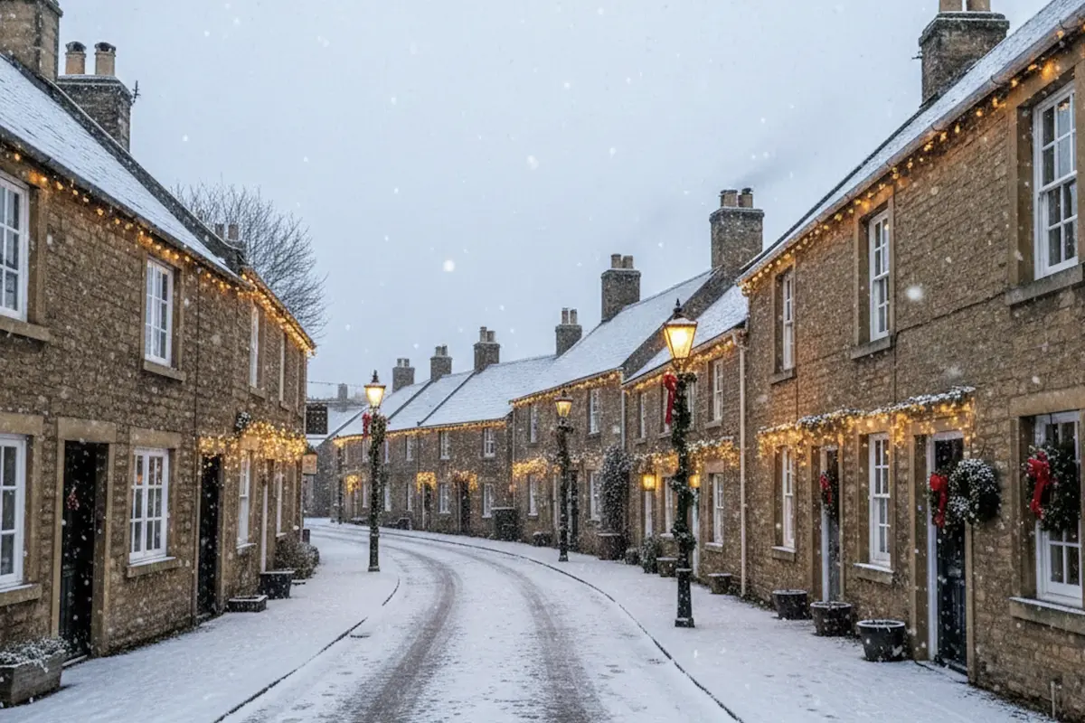
As Christmas 2025 gets close, many people across the UK are asking the same question: Will it snow on Christmas Day?
The latest weather forecasts say a true white Christmas is unlikely for most of the UK. But there is still a small chance that a few flakes of snow might fall in some areas.
Let’s break down what this means, why it’s unlikely, where snow might fall, and what the forecasts show for Christmas weather across the UK.
What Is a White Christmas?
Most people imagine snow lying thick on the ground on Christmas Day. But weather experts define it differently.
In the UK, a white Christmas is officially recorded when at least one snowflake is observed falling anywhere in the country on December 25. It doesn’t matter if it settles or sticks to the ground.
This means even a brief snow flurry counts as a white Christmas. But for most people, this isn’t the image they picture. Many want snow on the ground, covering roofs and streets like in Christmas movies.
Why White Christmases Are Rare in the UK
Snow at Christmas in the UK is not as common as many think. Here are key reasons:
1. UK Winter Weather Pattern
The UK lies in a region where weather comes often from the Atlantic Ocean. This brings mild, wet air in winter. Snow is much more likely in January and February than in December.
2. Warmer Winters Than in the Past
Snow at Christmas used to be more common in older centuries, especially before temperature records were kept. But climate change and higher average temperatures mean milder winters now. This reduces the chances of wide snow on Christmas Day. Wikipedia
3. Forecast Challenges
Snow is very hard to forecast weeks ahead. A tiny change in temperature or wind can turn snow into sleet or rain. Forecasters can only predict snow accurately about five days before Christmas.
Current Forecast for Christmas 2025
As of late December 2025, forecasters from the BBC Weather and the Met Office agree on this:
- The chance of snow falling somewhere in the UK is low but not zero.
- Most regions will see cloudy skies, rain showers, wind, and frost at night. The temperatures may be lower than recent weeks but still not cold enough for widespread snow. =
- High-pressure systems are expected to dominate, which usually means dry weather and frost rather than snow.
In simple words: most people will not see snow on Christmas Day, but it remains possible that a light snow shower or flurry could pass through some places.
Where Could Snow Happen?
Snow is more likely in specific areas if it does fall:
1. Higher Ground in Northern and Eastern UK
Snowflakes are often first seen over higher elevations like:
- Scottish Highlands
- Pennines
- Parts of northeast England
These areas have colder air and might see light snow showers even if the lower-ground areas do not.
2. Southern England (Small Chance)
Some models suggest that far southern parts of England might see a flurry near Christmas due to a cold, dry wind interacting with moist air. However, the chances remain small (less than 10%).
Even if snow does fall in these places, most of it will probably not settle on the ground.
History of White Christmases in the UK
Looking at past years helps set expectations.
- Since 1960, about half of all Christmas Days have seen at least some snow falling somewhere in the UK.
- But widespread snow lying on the ground is very rare. It only happened fully in years like 1981, 1995, 2009, and 2010.
- The last fully snow-covered Christmas was 2010.
- Technically, a white Christmas occurred in the UK as recently as 2023 because some snowflakes fell, though they didn’t settle.
This shows that while snow falling somewhere isn’t extremely rare, real winter wonderland scenes are. The UK usually sees snow more often after Christmas, especially in January and February.
How the Weather System Works
To understand why snow is rare on Christmas Day, we must know how UK weather works in winter.
Air Masses and Fronts
The UK’s weather depends on different air masses:
- Cold, dry air from the Arctic or Europe brings snow if it meets moist air.
- Warm, wet air from the Atlantic brings rain and mild temperatures.
For snow to fall, conditions must be just right. The air must be cold enough from the top of the clouds to the ground. A tiny rise in temperature can make snow turn into rain. This is why predicting snow far ahead is so hard.
Pressure Systems
When high pressure dominates, skies are clearer and drier. This increases frost but lowers the chance of significant snowfall. That’s what forecasters expect around Christmas 2025.
What Could Still Change Before Christmas?
Weather forecasts become more accurate the closer we get to the day. Snow forecasts, in particular, are better within five days before Christmas.
So even though most forecasts say snow is unlikely now, small changes in wind direction or temperature could still bring flakes to some regions. This is especially true for the north and east of the UK.
People living in places like Scotland should keep watching local updates as Christmas approaches.
What Does This Mean for You?
Here’s what to expect based on where you live and the forecast:
1. Scotland and Northern England
These areas have the best chance of seeing a snow flurry, especially on higher hills. But snow that settles on the ground is still unlikely.
2. Midlands and Wales
There might be cold showers or sleet, but snow is not likely to stay on the ground.
3. Southern England
Very light snow flurries might reach here only if conditions change. Most likely, you will see rain or dry, cold weather.
4. London and Southeast
Snow here is rare and unlikely in the current forecast. But all it takes is one flake anywhere for it to be technically declared a white Christmas.
Winter Safety Tips
Even if snow is not guaranteed, winter weather can still bring hazards. Here are simple safety tips:
- Watch weather warnings for frost and ice.
- Drive carefully if the surfaces are slippery.
- Keep warm during cold nights.
- Check in on older neighbours who may find winter cold hard.
Cold weather can be just as dangerous as snow if roads freeze or rain turns to ice.
Christmas Weather Quick Facts
| Fact | Detail |
|---|---|
| What counts as a white Christmas? | At least one snowflake falling somewhere in the UK on December 25. |
| Snow lying on ground | Much rarer — last widespread ground snow in 2010. |
| When snow is likely | More in January and February than in December. |
| UK Christmas 2025 forecast | Snow unlikely, frost and dry conditions more likely. |
| Best areas for flakes | Northern and eastern high ground. |
Final Thoughts
Even though a snowy Christmas morning may sound magical, conditions in 2025 are not lining up for widespread snow. Most of the UK will likely see cold, cloudy weather and frost, not snow.
But weather can surprise us. A few snowflakes here or there could still fall and give some people that festive feeling. And remember — all it takes is one flake for the UK to technically have a white Christmas!
So keep watching the forecast right up to December 25. You might still get that sparkle of snow in your town.